
Tropical Cyclone
Recent South Pacific satellite image and analysis chart courtesy NOAA;


Note: for sea surface temperatures (SST), wind and swell see the Marine page
South Pacific & Australia RSMC/TCWC Official Warnings and Forecasts
RSMC Nadi - Fiji Meteorological Service - homepage
» Latest TC track map and threat map
» 5-day TC Outlook
» Tropical Disturbance Summary and Advisory
TCWC Melbourne - Australia Bureau of Meteorology - homepage
» Current Tropical Cyclones - map with links to TC track map and bulletins if current
» 7-Day Forecast - map with 12 hour timesteps showing chance of TC
» Tropical Climate Update - weekly in wet season, fortnightly in dry season
TCWC Wellington - New Zealand MetService - homepage
» Current TC Activity - 5-day Outlook, analysis, satellite, and track map if current
Non-WMO and other NMHS cyclone warnings/tracks
Joint Typhoon Warning Centre - with forecast tracks (Pacific/Indian Oceans)
South Pacific NMHSs issuing TC advice
» New Caledonia
» Vanuatu
» Tonga - see Tropical Cyclone in left menu
» American Samoa - via US NWS
GTS Text Bulletins
Grouped by issuing centre via Tokyo Global Information System Centre
» Nadi = NFFN, Brisbane = ABRF, Darwin = ADRM, Perth = APRF, Wellington/Kelburn = NZKL
Grouped by header code via NOAA
Forecasts/Tracks
HAFS - Hurricane Analysis and Forecast System - via NOAA (replaces HWRF)
Tropical Tidbits - info on current systems, with tracks, JTWC and ensemble maps
Weathernerds TC Guidance
ECMWF TC tracks - current and past cyclones
ECMWF ensemble tracks via: Easterlywave or Meteologix
NCAR Tropical Cyclone Guidance Project (new site) - incl multi-model tracks (old site)
Global tropical cyclone tracks - by Brian McNoldy
UK Met Office forecast track bulletin - S.Pacific & SE.Indian (via NOAA)
Cyclone Phase Evolution - analysis and forecasts from several global models
Cyclocane tracking map
WMO Severe Weather Information Centre - links to official obs+warnings
Observations/Analysis
MetService South Pacific analysis
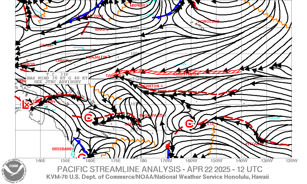
Streamline analyses - from NWS/NOAA - or straight to latest Pacific analysis (to 30S)
BoM Weather maps - including gradient wind analysis
NRL TC Page (old) - microwave and satellite imagery (new page here), also with;
» COAMPS-TC - tropical cyclone prediction and verification (tracks and model forecasts)
NOAA SAR - Synthetic Aperature Radar Products
NESDIS/NOAA Tropical Cyclone Products
» Tropical Cyclone Satellite Imagery - Storm Floaters
» Tropical Bulletins - fixes, see also the storm position page, and storm microwave position page
» ADT - Advanced Dvorak Technique - for active storms
CIMSS - Uni of Wisconsin - TC info and imagery
» including Advanced Dvorak Technique (ADT) for current systems and SATCON intensity estimates
CIRA/RAMMB Real-Time TC Products - with satellite imagery and analysis data incl digital dvorak
JTdiag - graphical plot of diagnostics from Mike Fiorino (GFS/EC/CMC/NAVGEM/JMA)
MIMIC-TPW ver.2 - via SSEC, Uni of Wisconsin
CIRA Advected TPW2 - via Colorado State Uni
OSPO Blended TPW - via NOAA
NOAA NESDIS STAR 24hr satellite rainfall estimates - or jump straight to Aus/NZ area
NASA Global Precipitation Measurement - IMERG, see also global viewer

Pre-formation/Monitoring
Weather Geek Tropical Cyclone Genesis Watch - all-in-one page for TC Outlooks
Cyclocane - CYCLOne and hurriCANE tracker (similar to above)
ECMWF TC activity and genesis - short/medium range (12 days)
ECMWF TC probability - extended range forecast (4 weeks)
ASSESS-S TC formation probability (change category to TCs...)
48h TC formation probability - from RAMMB CIRA via NOAA OSPO (also: static maps)
Global
Tropics Hazards Outlook - weeks 2-3, via NOAA NWS CPC
JMA SWFDP for RA V: South Pacific - GSM and EPS products
Tropical Tidbits forecast models - incl GFS, CMC, NAVGEM, HWRF...
TCgen - multi-model plots from Mike Fiorino (GFS/EC/CMC/NAVGEM/JMA)
MJO monitoring and forecast - via BoM
MJO/Kelvin/ER plots and animations - Real Time CFS Tropical Mode Projections from Kyle MacRitchie
MJO current/forecast conditions via NOAA NCEP CPC (with link to Dynamic Model MJO Forecasts)
OLR
- Outgoing Longwave Radiation - many plots (incl totals and anomalies) via NOAA PSL
Southern Hemisphere Blocking - NOAA
Pacific Island Nations
Papua New Guinea
Solomon Islands
Vanuatu
New Caledonia - in french from Météo-France
Fiji
Tuvalu
Kiribati
Western Samoa
American Samoa
Tonga
Niue
Cook Islands
French Polynesia - in french from Météo-France
Reference
Worldwide official TC names at WMO - lists also at Wikipedia and NWS NHC

Real-time Global TC Activity - basin lists with stats
Wikipedia Tropical Cyclone Page - loads of info! with cumulative track maps
» also with list of SH Tropical Cyclone Season pages
IBTrACS - International Best Track Archive for Climate Stewardship
» Browse via NCICS/CISESS
» Also: NOAA Historical Hurricane Tracks
Hurricane Satellite (HURSAT) Data
SPEArTC - Southweast Pacific Enhanced Archive for Tropical Cyclones
BoM Southern Hemisphere Tropical Cyclone Portal
JTWC Southern Hemisphere Best Track Data
CSIRO
NESP TC Projections Portal - incl historic tracks
WWLLN
TC page - visualisations of lightning and microwave satellite data for TC's
Tropical Cyclone Scales - info and comparisons via Wikipedia
Australia TC Knowledge Centre - from BoM
The Saffir-Simpson Hurricane Scale - from NHC
Dvorak Current Intensity chart - from NOAA OSPO
WMO Tropical Cyclone Programme - incl reports and other publications
» Tropical Cyclone Forecaster Website
» Global Guide to Tropical Cyclone Forecasting